How to Create an Interactive Coverage Map from KML/KMZ Files in Minutes
Overview
Convert your existing Google Earth/Maps KML files into an interactive "Do you service my area?" widget for your website. This guide will show you how to:
- Convert KML/KMZ files into an interactive service area checker
- Let customers verify service availability by address or postal code
- Display a visual coverage map of your service territories
- Add the widget to your website - no coding required!
Step 1: Create Your Account
Visit ServiceAreaWidget.com and click "Try it free" to start your 7-day trial or free plan.
Step 2: Set Up Custom Fields
Custom fields are available on paid plans only.
In your dashboard's "Fields" section, configure the information you want to display for each service area (pricing, hours, descriptions, etc.).
Step 3: Import Your KML/KMZ File
- Export your service areas from Google Earth/Maps as KML/KMZ
- In your dashboard, click "Import Areas"
- Drag and drop your file or click to select it
- Map your KML data to your custom fields:
- Choose which KML data matches your area names and descriptions
- Map any additional KML data to your custom fields
- Review and edit area information as needed
- Click "Import Areas" to complete the process
Step 4: Configure Your Widget
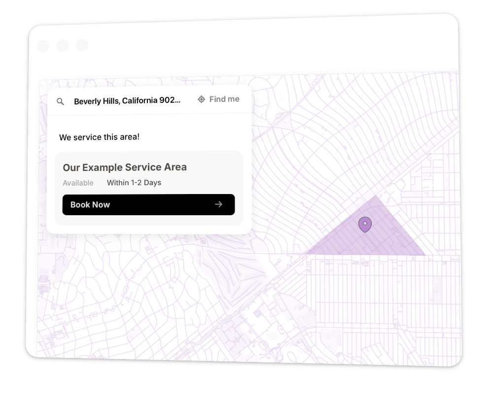
Choose your preferred display format:
- Coverage Map: Visual map of all service areas
- Address Checker: Simple address lookup tool
- Combined: Both map and address verification
Step 5: Add to Your Website
Copy your unique widget code from the dashboard and paste it into your website where you want the widget to appear.
Need More Help?
Check out our complete setup guide for detailed screenshots and platform-specific installation steps.
Need help? Email us at [email protected]